The Salento is an area rich in parks, protected areas, nature reserves and oases and, more generally, areas of historical and landscape interest.
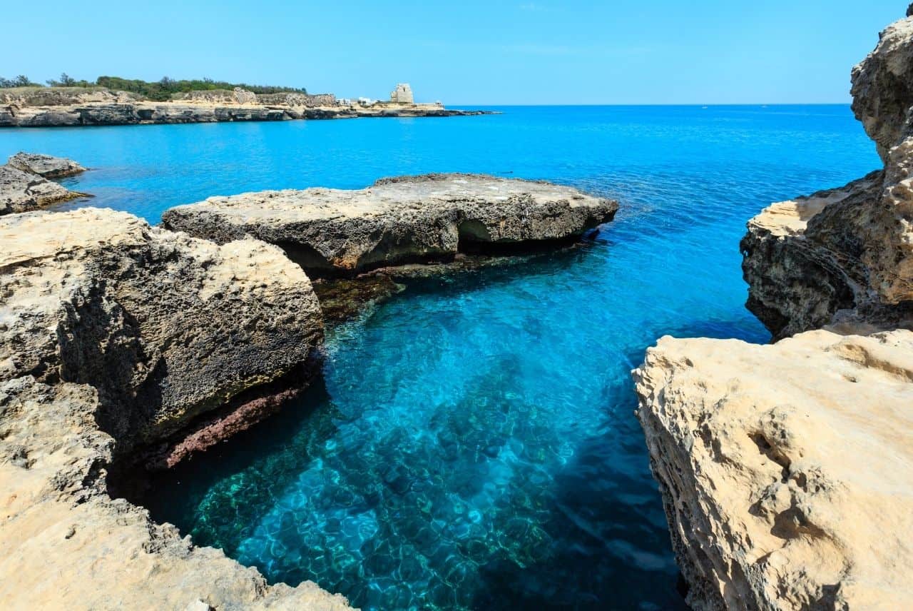
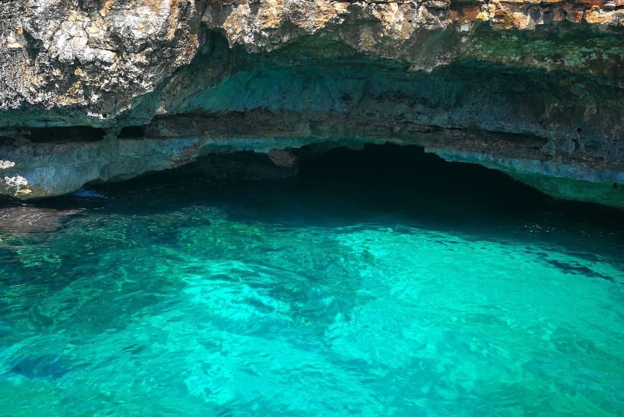
Roca
Adriatic coast
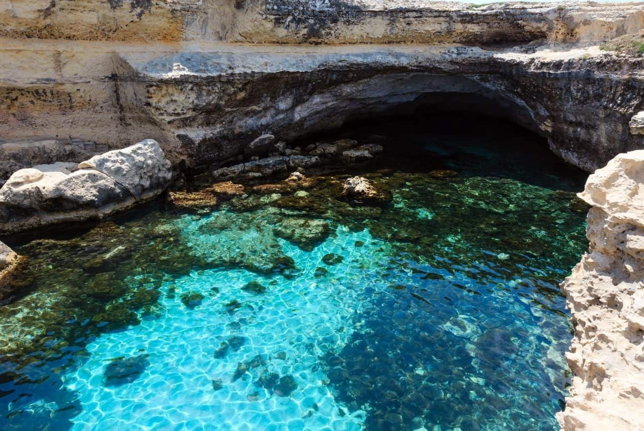
Cave of Poetry
The site of important archaeological excavations, it is a popular tourist destination in the summer with its 16th-century watchtower, the ruins of the castle overlooking the sea, the 17th-century sanctuary of the Madonna di Roca and the two Posia caves (from the Greek, “spring of fresh water”), better known as the Poesia caves. The latter, in particular, about 60 metres apart, are karstic caves whose roofs have collapsed and sea water reaches the caves through a channel that can be travelled by swimming or by small boat. The larger of the two (40°17′09″N 18°25′46″E) has a roughly elliptical plan with axes of about 30 and 18 metres and is about 30 metres from the open sea. Posia Piccola, on the other hand, has axes of about 15 and 9 metres and is separated from the open sea by about seventy metres as the crow flies. Its considerable importance in archaeological terms is linked to the discovery in 1983 of Messapic (but also Latin and Greek) inscriptions on its walls, from which it was possible to establish that the cave was once a place of worship of the god Taotor (or also Tator, Teotor, or Tootor).
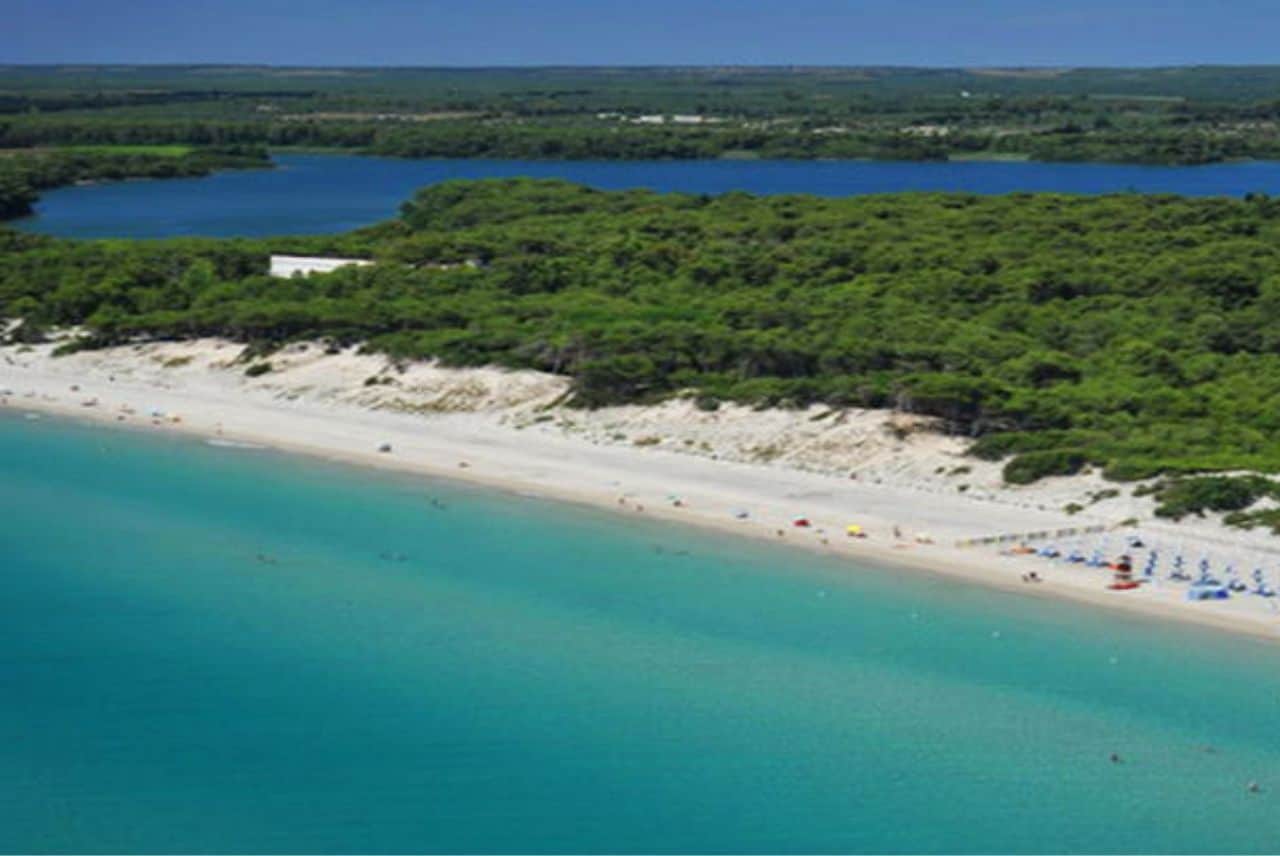
Alimini
Adriatic coast
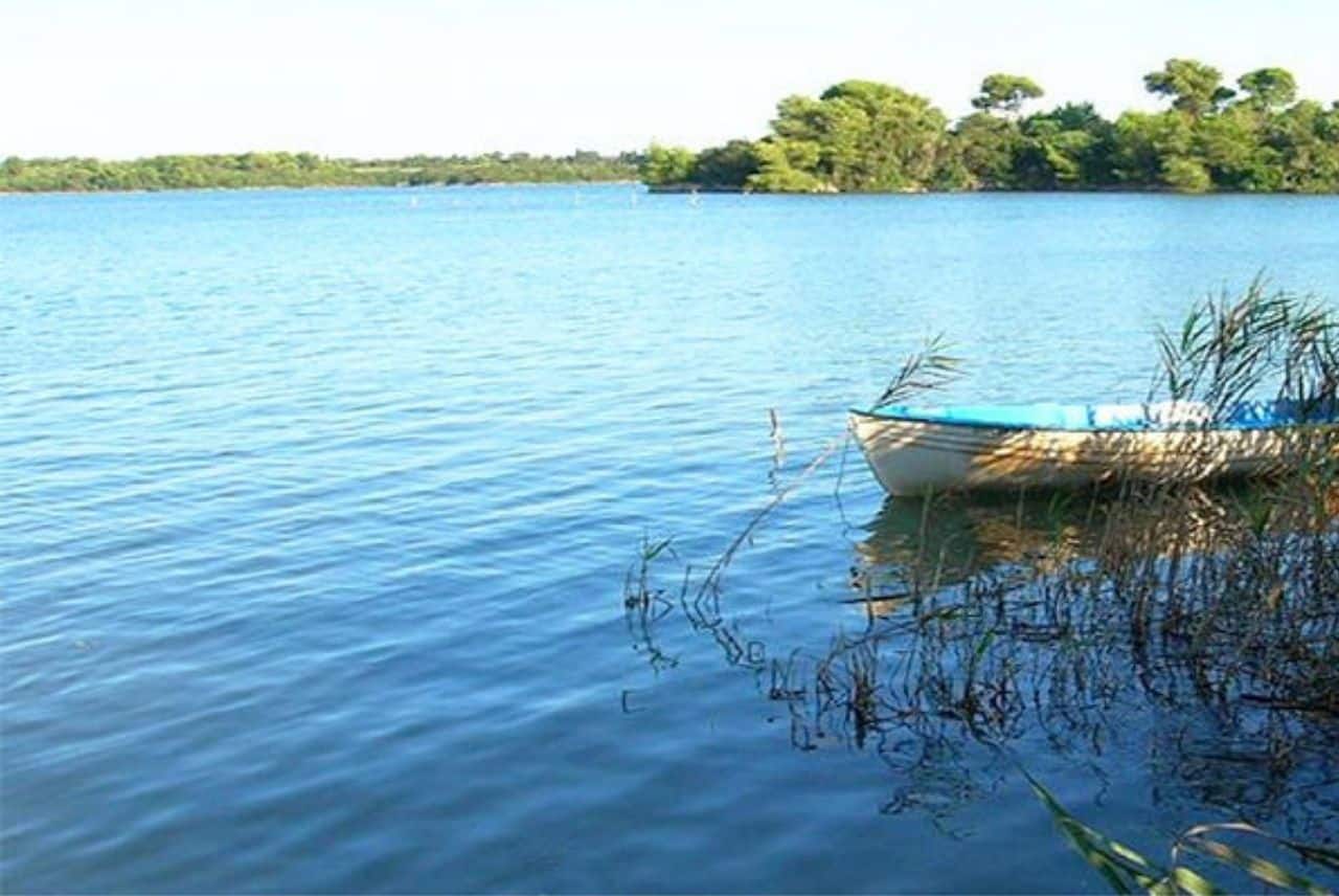
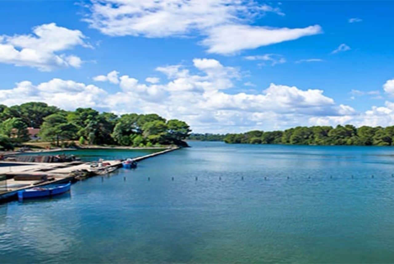
Alimini Lakes
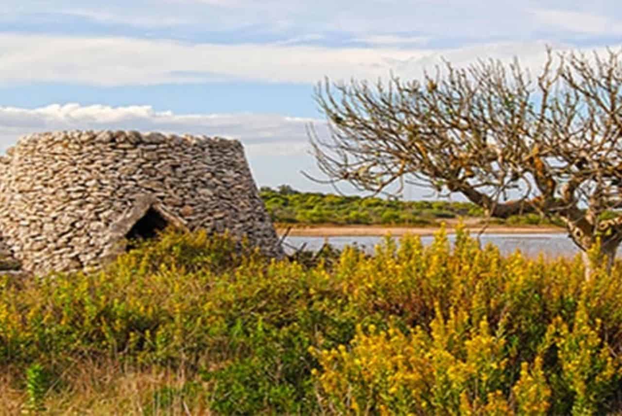
The Alimini lakes are two elongated bodies of water parallel to the coastline. The vegetation includes marsh reed, sedge and shaggy sedge. Alimini Grande is surrounded by a rocky crown, while the vast northern stretch known as Palude Traugnano is home to the very rare Periploca graeca. The northern part is cultivated and appears barren and studded with “specchie”; the south-western side, reforested in the 1950s, is currently a game reserve. The south-eastern part, now a protection oasis, is instead characterised by dense Mediterranean scrub vegetation and rare Apulian heather. Towards the south, Alimini Grande narrows until it joins Lake Fontanelle (Alimini Piccolo); here the landscape presents a modest rocky relief bordering the lake and in which primitive man's shelters open up. Fontanelle is surrounded by marsh vegetation and its fresh waters are home to the marsh orchid, the water chestnut and the bladderwort, the only carnivorous plant of Apulian flora. The lakes are an ideal habitat for coots, pochards, mallards, anatids in general, cormorants, herons and gulls.
Le Cesine
Adriatic coast
Protected Nature Reserve
In 1971, the Ramsar Convention declared the Cesine to be a wetland of international value, covering an area of 620 hectares, part of which is the nature reserve, recognised by the Italian State in 1979. The area, whose name derives from the term "segine" (abandoned area), is now one of the increasingly rare habitats for numerous animal and plant species, which are seriously threatened in much of the Salento Peninsula. The marshy area is invaded by dense stands of marsh reed, sea squill, prickly rush, black rush, serotine statice, saltmarsh asters and the extremely rare Ipomena sagitta. The less salty marshes are home to the water lily, a rare plant with large yellow flowers, the marsh orchid, the Cretan thistle and the water lentil. The fauna includes the pochard, the mascot of the oasis, coots, mallards, Turkish ducks, royal swans, white herons and cormorants, water tortoises and tree frogs. The pine forest has slowly begun its conversion into scrubland. In the undergrowth are myrtle, lentisk, cistus, heather manipuliflora, of Balkan origin, and rare orchids. Entrance is only permitted with the guidance of WWF volunteers.
Otranto
Adriatic coast
Bauxite quarry
Otranto's bauxite quarry is one of Salento's must-sees and is located near the Punta Palascia lighthouse and Monte Sant'Angelo. This now disused bauxite mining site has formed an emerald green lake that makes for an extraordinary panorama, and the bauxite quarry is one of the most photographed places in Salento. Bauxite mining in the Otranto quarry began in 1940 and ended in 1976; the formation of the emerald green lake was most likely due to water infiltration from the water table in the area. This is an area of great landscape and environmental interest.